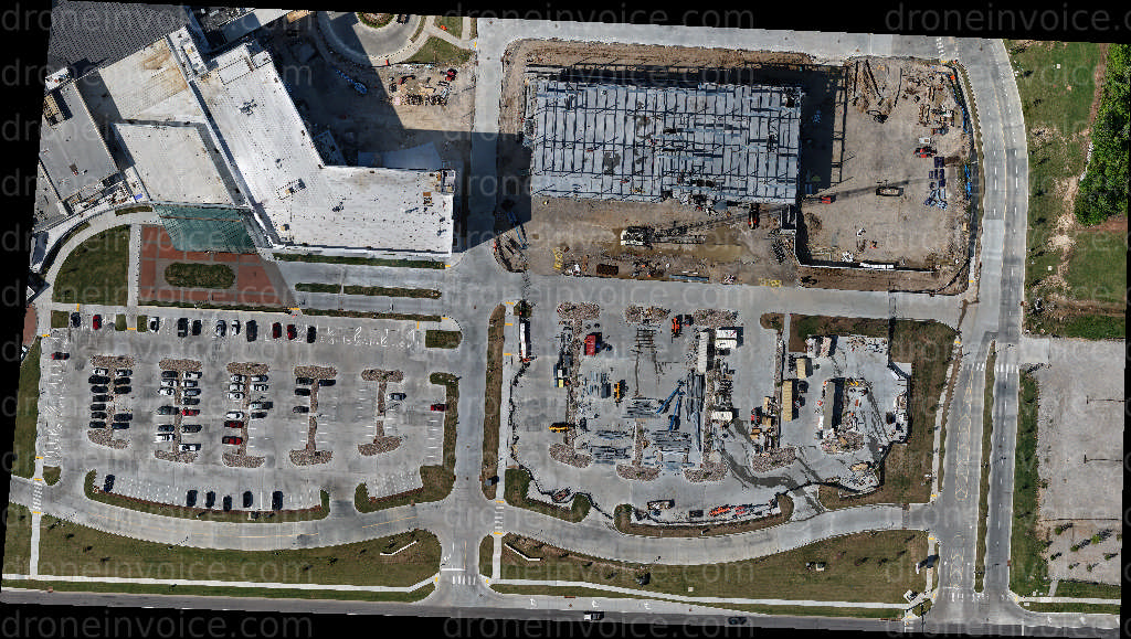
426 East 121st St S — Broken Arrow, Oklahoma (ok), United States (us)
Orthomosaic Photo of Spring Creek Crossing construction site. Available to license for ¤500.00 on DroneInvoice.
Map
No location data.
Top 5%
us/ok

SKYSIDE PHOTO
Last active 13 days ago
FAA Part 107 Licensed • OSHA-10 Certified • Fully Insured
Commercial drone specialist delivering precision data and premium visuals. RTK Photogrammetry, Orthomosaic Mapping, Construction Tracking, Roof Inspections.
License / Certification
FAA Part 107 #4372737
297 total views last week
Request a quote
View Pilot Portfolio
Nearby Content (6)
Photo
Rose Graham Quilting Retreat Family Friendly Pets Welcome Gem
8192x6144 (50MP)
2026-05-03
2026-05-03
$20.00
USD
Photo
Family Friendly Pets Welcome Gem
4096x3072 (13MP)
2026-05-03
2026-05-03
$20.00
USD
Photo
Family Friendly Pets Welcome Gem
8192x6144 (50MP)
2026-05-03
2026-05-03
$20.00
USD
Photo
Family Friendly Pets Welcome Gem Faith Fellowship Church
8192x6144 (50MP)
2026-05-03
2026-05-03
$20.00
USD
GeoTIFF
10501 E 91st St S
12469×7054 px @ 2.76 cm/px
2026-04-30
2026-04-30
Buy Bundle Only
GeoTIFF
10111 E 81st St suite d
7699×5511 px @ 2 cm/px
2026-05-19
2026-05-19
$300.00
USD