Drone Maps of Kansas Available to Purchase – Andover, Kansas (KS), US (US)
Drone Maps of Kansas Available to Purchase Kansas is known for its vast plains, rolling hills, and charming small towns, making it a unique location…
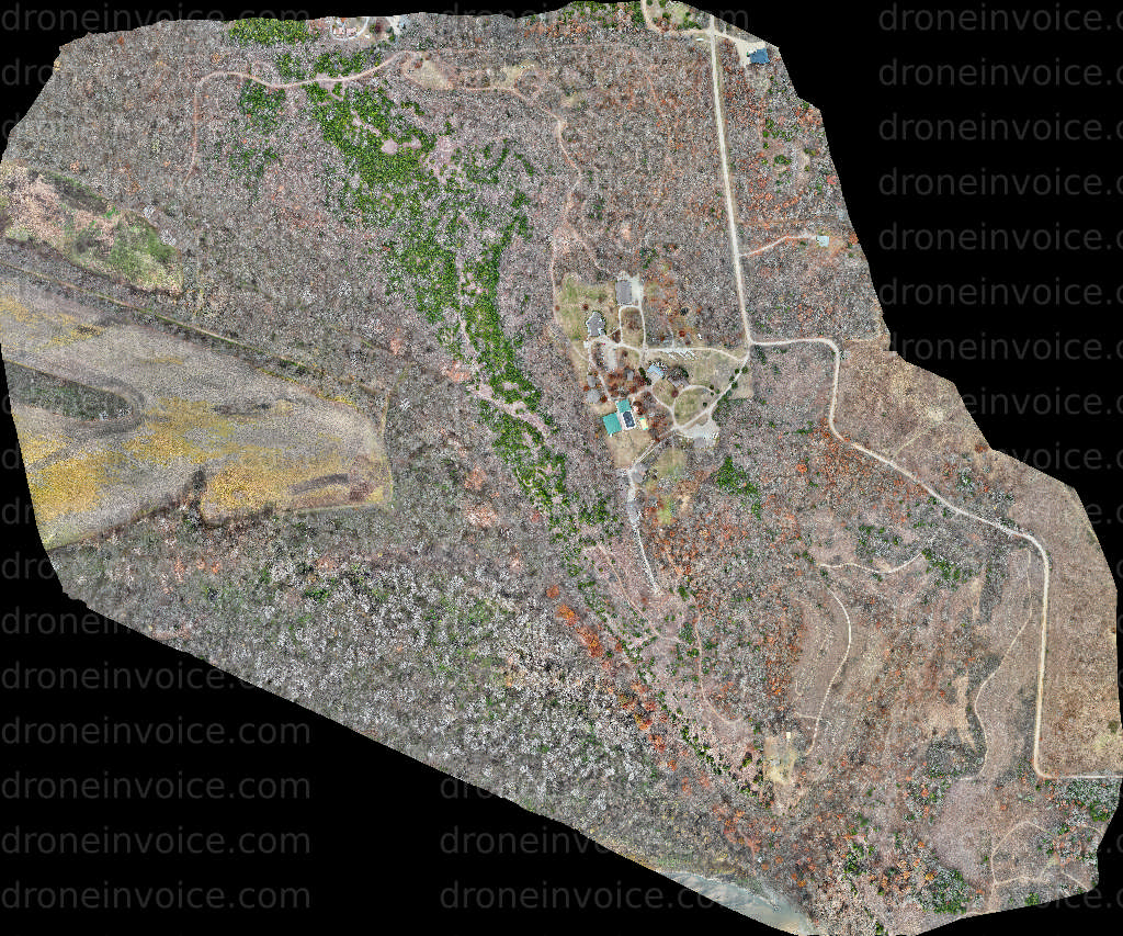
Media
Showing 10 of 10
2026-01-02
2026-01-02
2026-01-02
2026-01-02
2026-01-02
2026-01-18
2026-01-02
2026-01-02
2026-01-08
2026-01-12
Drone Maps of Kansas Available to Purchase
Kansas is known for its vast plains, rolling hills, and charming small towns, making it a unique location for aerial mapping. From the expansive prairies to the bustling cities, drone maps provide a comprehensive overview of the landscape, helping various industries and individuals in their planning and decision-making processes. Whether you are a developer, a researcher, or just curious about the geography of Kansas, our collection of drone maps offers a detailed and accurate representation of the region.
This page features high-quality drone maps of Kansas available for purchase. These maps are created using advanced drone technology, ensuring precise geolocation data and stunning visuals. Our library includes a variety of map types, such as topographic maps, orthophotos, and 3D models, each serving different purposes and applications.
Types of Drone Maps Available
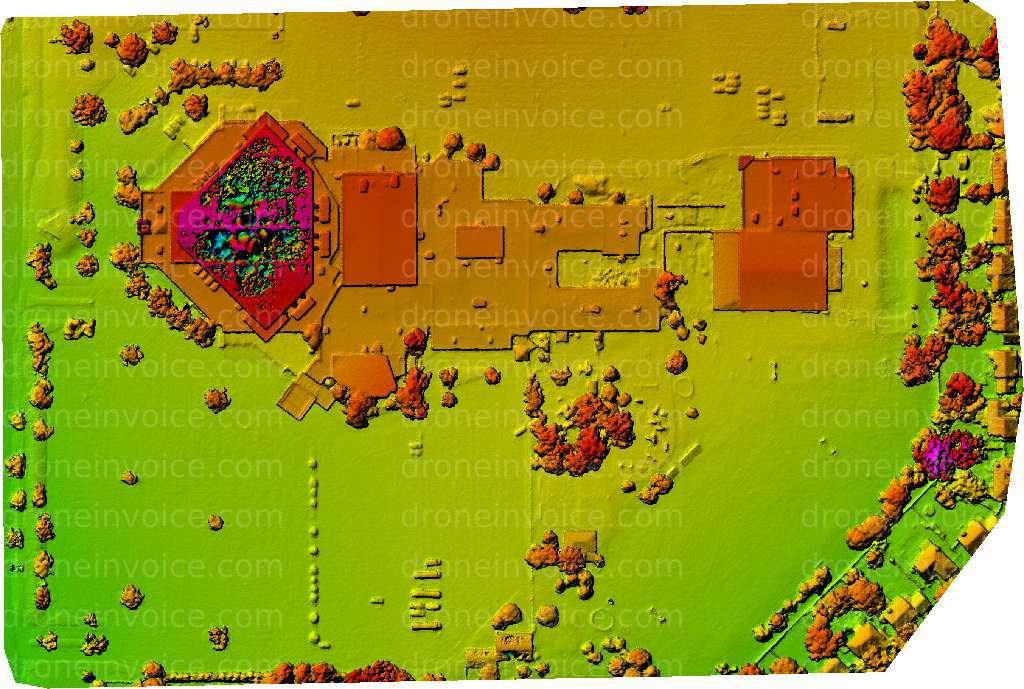
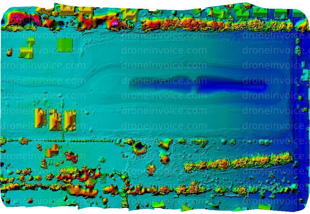
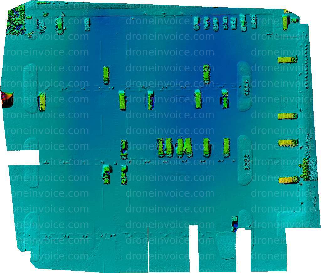
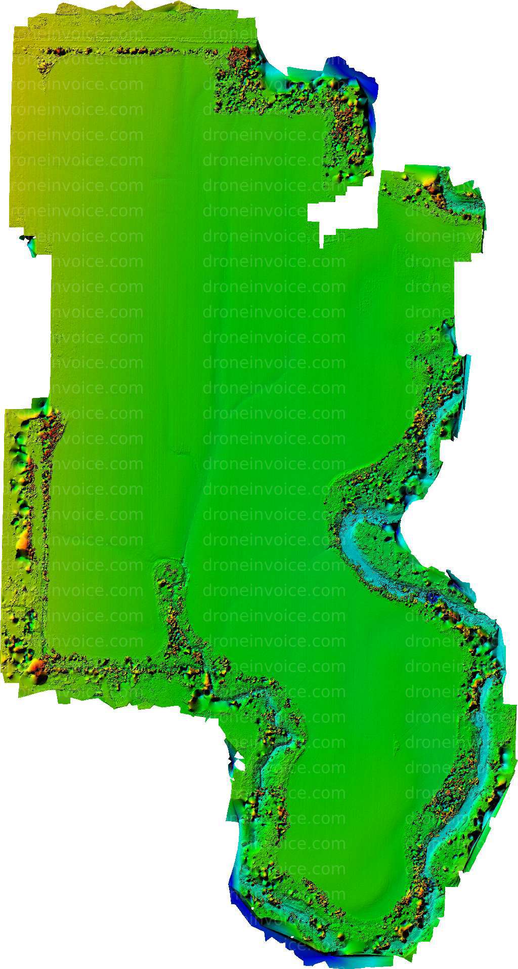
- Topographic Maps: These maps showcase the elevation and terrain features in Kansas, making them ideal for land-use planning, construction projects, and outdoor activities.
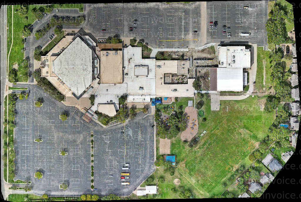
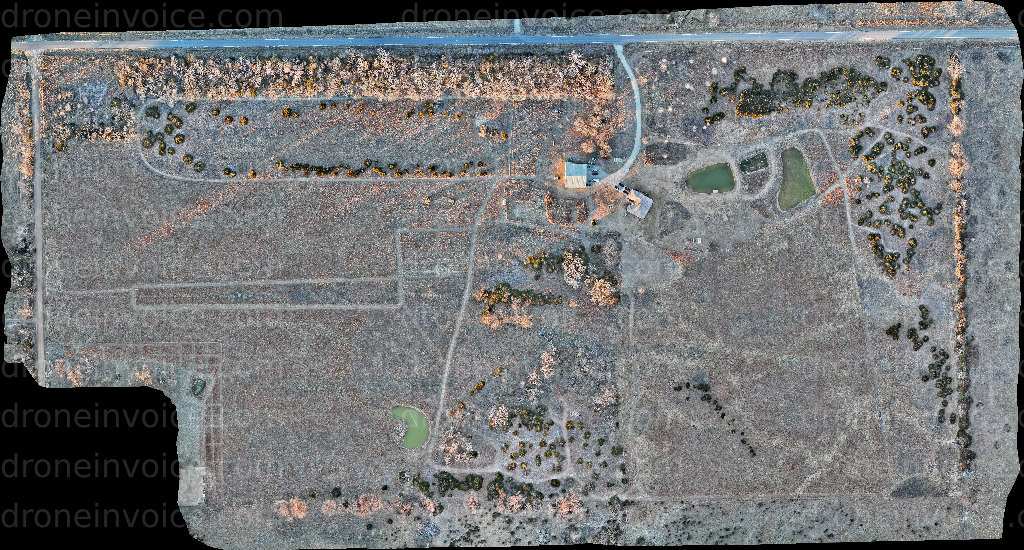
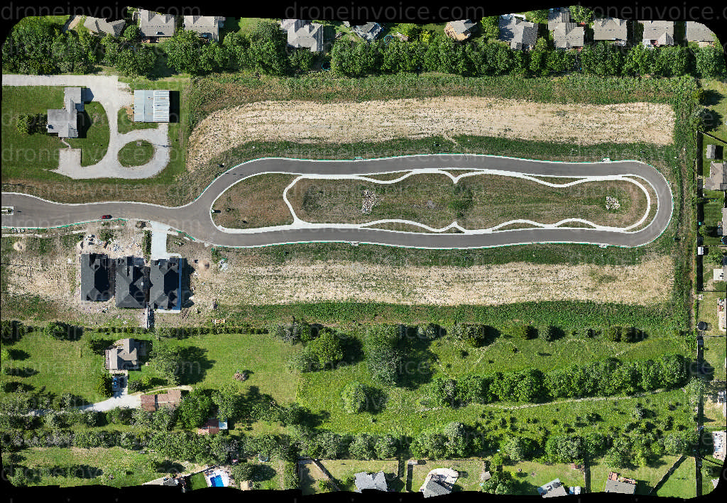
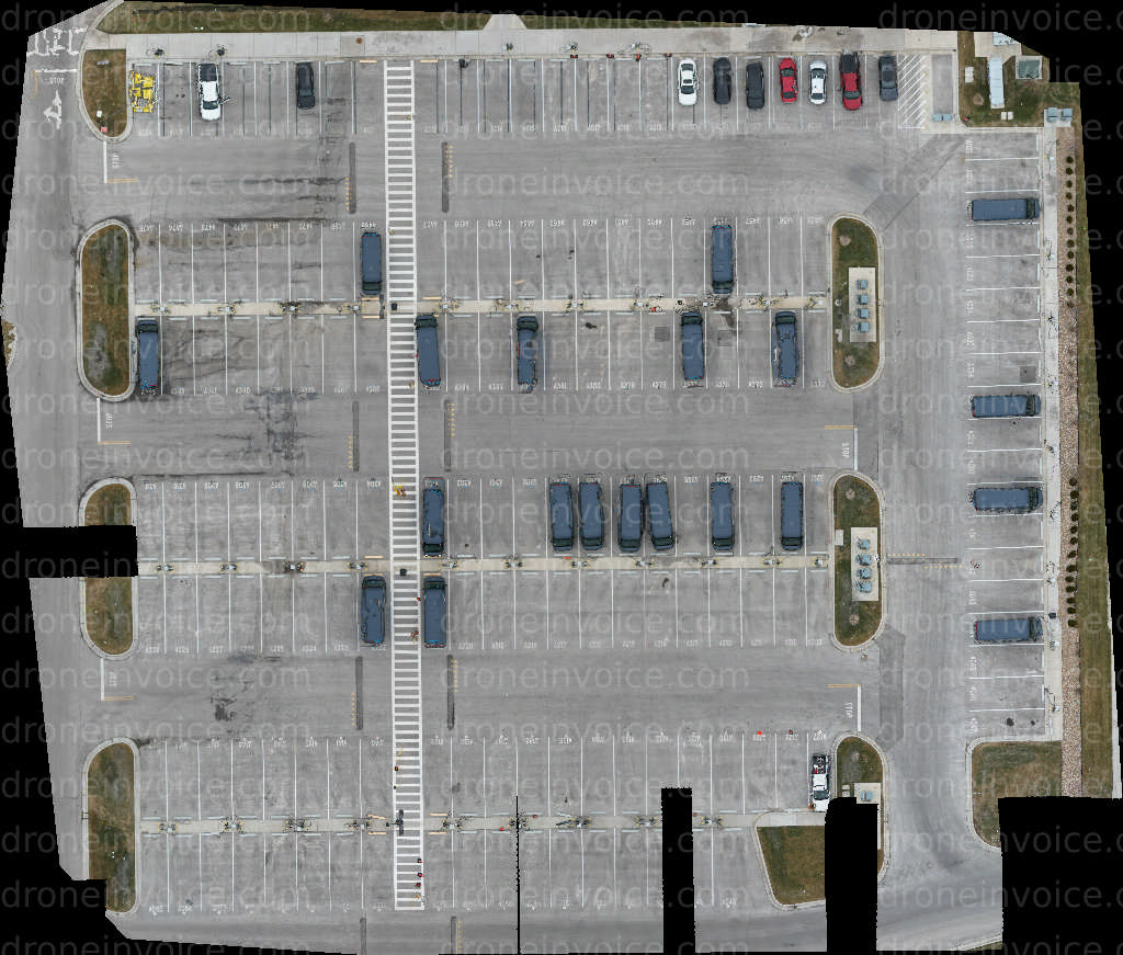
- Orthophotos: Aerial images corrected for distortion, orthophotos provide high-resolution visuals of the landscape, perfect for environmental studies and property assessments.
- 3D Models: These models give a detailed view of the terrain, allowing for in-depth analysis and visualization of geographic features.
Our maps are beneficial for a range of users, including urban planners, architects, environmentalists, and educators. With the help of drone technology, you can gain insights into land use, resource distribution, and spatial planning in Kansas.
How to Purchase Drone Maps
Purchasing drone maps from our marketplace is straightforward. You can browse through our collection, view the available maps, and select the one that meets your requirements. Each map comes with detailed descriptions, including scale, resolution, and specific features. Once you choose a map, you can easily complete your purchase through our secure online platform.
For those interested in custom mapping services, we also offer bespoke solutions. If you need a map tailored to specific dimensions or features, please reach out to us for assistance. Our team can coordinate with drone pilots to create the exact mapping solution you need.
Benefits of Using Drone Maps
- Accuracy: Drone maps provide precise data, crucial for effective planning and analysis.
- Cost-Effectiveness: Aerial mapping can be more economical than traditional surveying methods.
- Accessibility: Maps can be easily accessed and shared digitally, facilitating collaboration among stakeholders.
In addition to the benefits mentioned above, drone maps can enhance your understanding of Kansas’s geography and help visualize changes over time, making them invaluable for historical comparisons and future planning.
Applications of Drone Maps in Kansas
Drone maps are widely used in various sectors, including:
- Real Estate: Real estate agents can utilize drone maps for property listings, showcasing land features and nearby amenities.
- Agriculture: Farmers can analyze crop health and land conditions, optimizing their farming practices.
- Environmental Studies: Researchers can monitor ecosystems and assess environmental changes effectively.
With such versatile applications, investing in drone maps can greatly enhance your project outcomes and provide valuable insights into the Kansas landscape.
FAQ
What is the resolution of the drone maps?
The resolution of our drone maps varies by type, but we ensure high-quality images suitable for both professional and personal use. Details are provided on each map’s description page.
Can I get custom maps created?
Yes, we offer custom mapping services. Simply contact us with your specific requirements, and we can work with our drone pilots to create a tailored map for you.
What formats are the drone maps available in?
Our drone maps are available in various formats, including JPEG, GeoTIFF, and 3D model files, ensuring compatibility with different software and applications.
Are the maps licensed for commercial use?
Yes, our drone maps come with licensing options for both personal and commercial use. Please review the licensing terms provided with each map for specific details.