Invoice #2
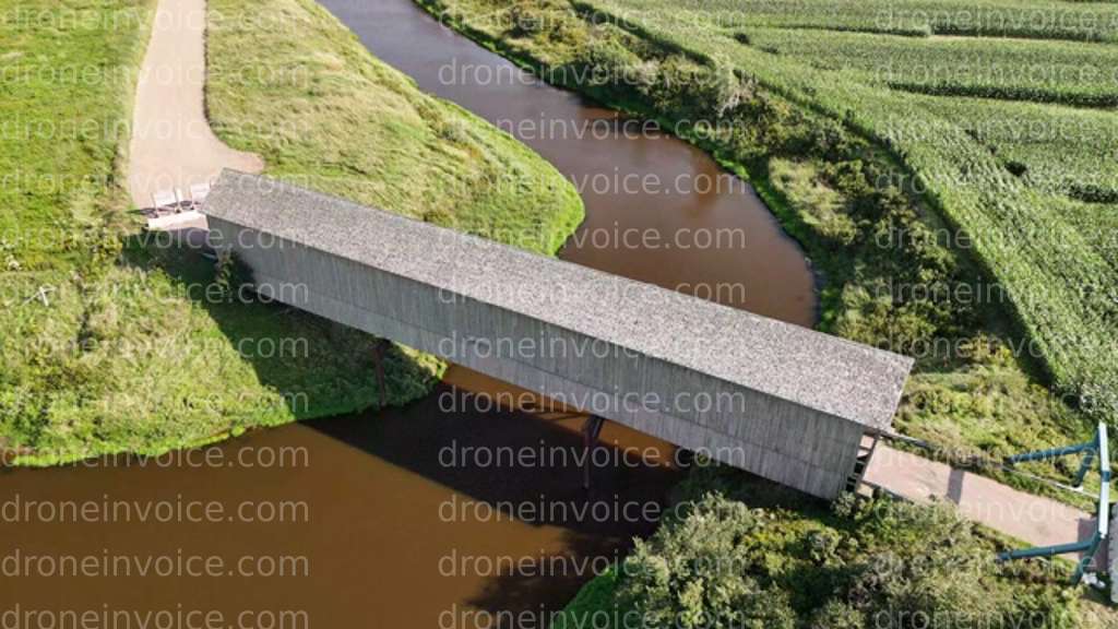
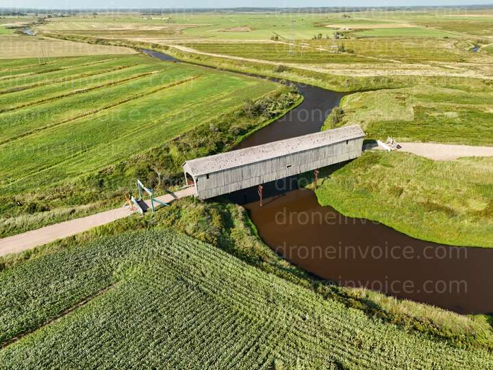
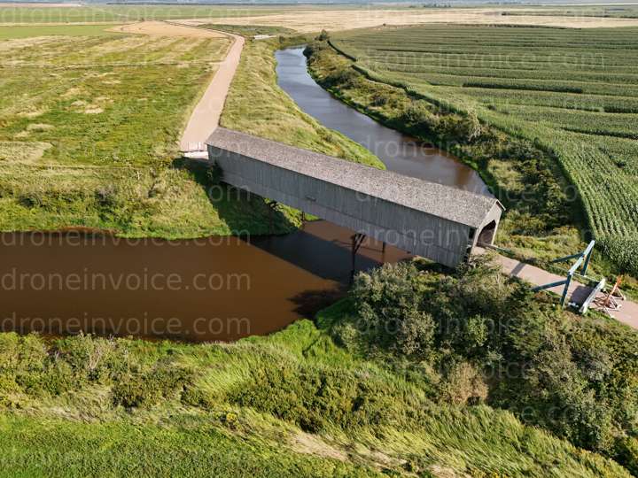
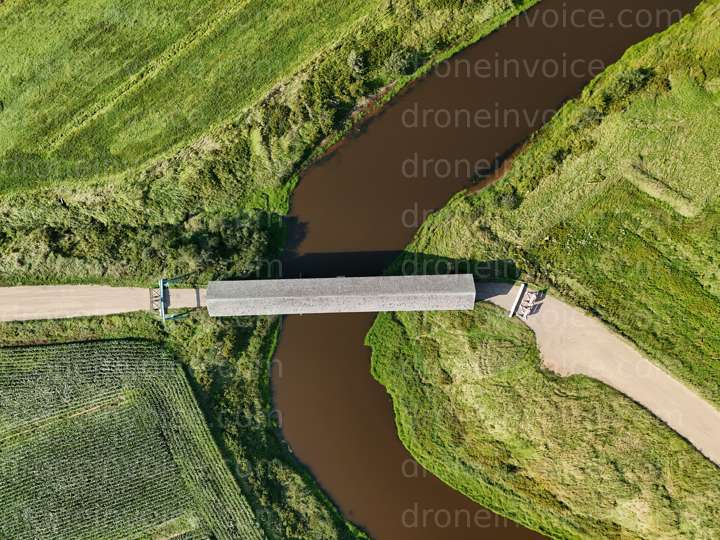
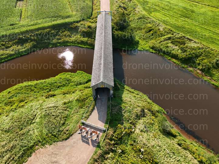
Historic Wheaton Covered Bridge
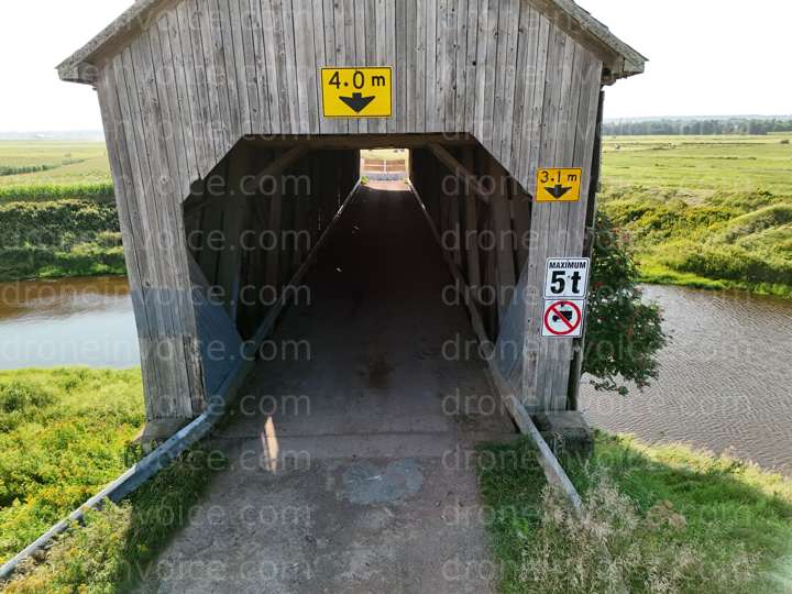
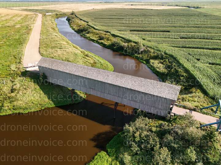
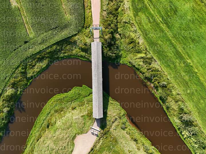
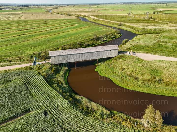
Known locally as Wheaton Covered Bridge is located along High Marsh Road, in Sackville, New Brunswick. Built, in 1916, it is about 50 m long, and named after Thomas Wheaton, who lived in the last house on the road before the bridge, and may have, at the time of building the bridge, owned the land where the bridge is located. The bridge was closed to traffic in summer of 2024. https://geomatics.one/Aerial_Views/covered-bridge

Select a file
Click a marker or any thumbnail to preview it here.
Top 5%
ca/nb

Geomatics
Last active 58 days ago
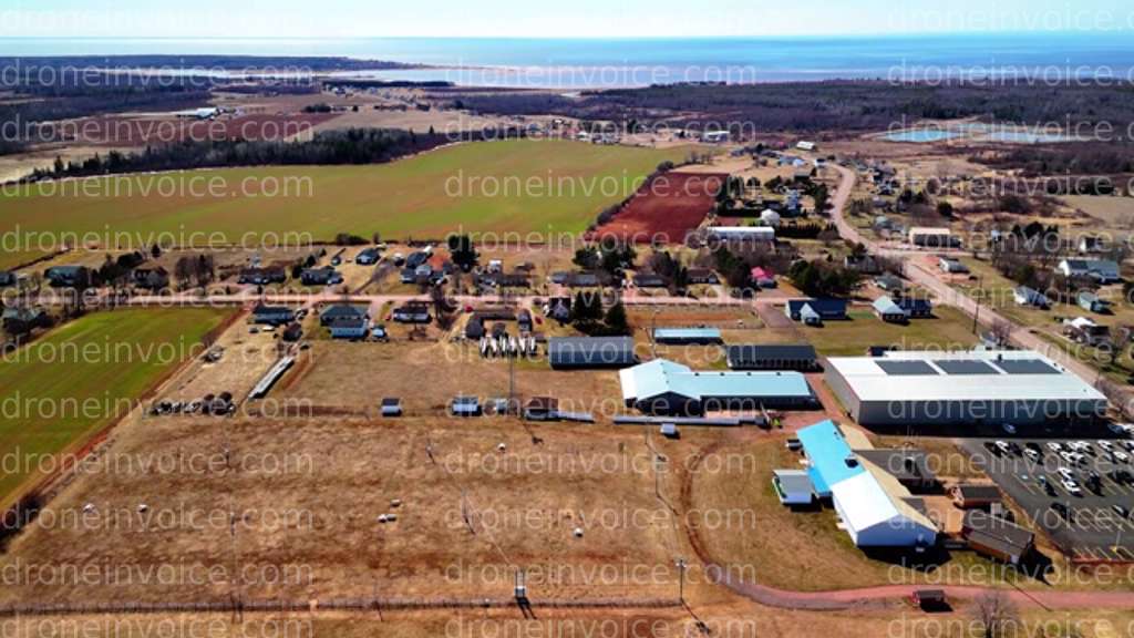
Certified Geomatics Specialist and Licensed RPAS Pilot providing high resolution aerial mapping services all across New Brunswick, Nova Scotia, and Prince Edward Island.
https://www.Geomatics.one
License / Certification
PC2211203595
348 total views last week
Request a quote
View Pilot Portfolio