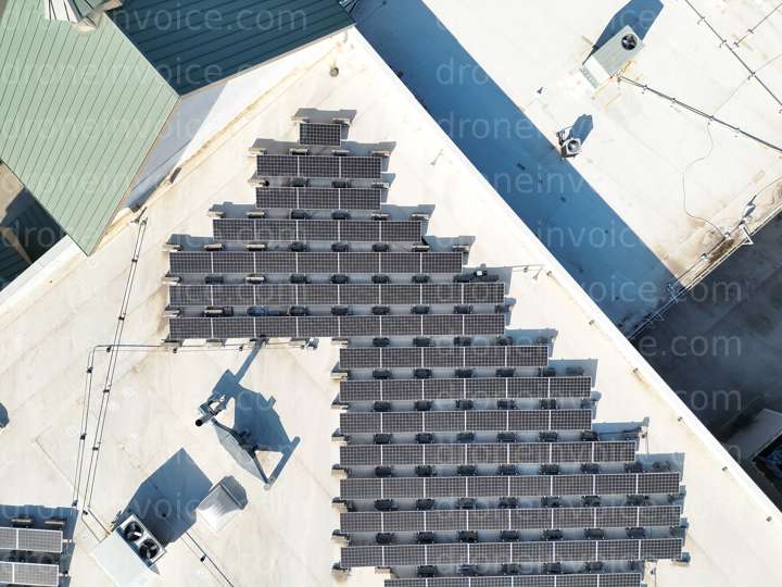
Solar Thermal Rooftop survey — Colleyville, Texas (tx), United States (us)
Drone Photo captured on December 25, 2025 in Solar Thermal Rooftop survey, Colleyville, Texas (tx), United States (us) using dji dji matrice 4t. 4032x3024…
Map
No location data.

Blackland Aerial Imaging
Last active 101 days ago
Blackland Aerial Imaging (BAI) delivers drone and ground photo/video plus RTK photogrammetry, orthomosaics, and aerial surveys. Equipped with a GNSS base station for centimeter-level accuracy for real estate, construction, and utilities.
License / Certification
FAA Part 107 #5245256
26 total views last week
Request a quote
View Pilot Portfolio
Nearby Content (2)
Video
708 Lyndsey Wy
1920x1080 @ 29.97 fps
2026-01-21
2026-01-21
$20.00
USD
Photo
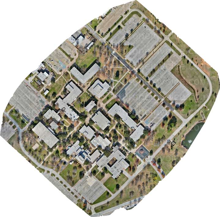
Photogrammerty College Campus
12878x12701 (164MP)
2026-01-17
2026-01-17
$14.11
USD