Drone Maps of Poland Available to Purchase – Białystok, Województwo podlaskie, Poland
Drone Maps of Poland Available to Purchase Poland, a country rich in history and diverse landscapes, offers a variety of stunning views—from the…
Media
Showing 2 of 2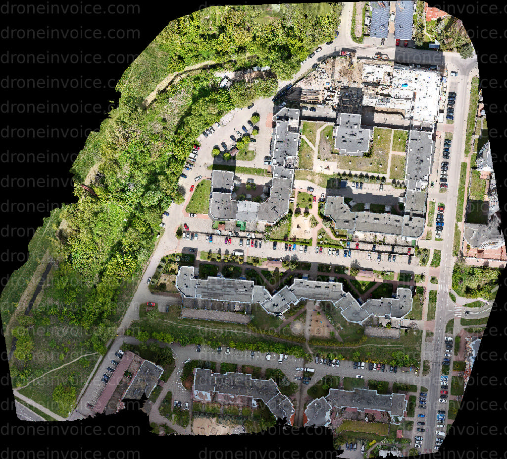
2025-11-25
2026-04-24
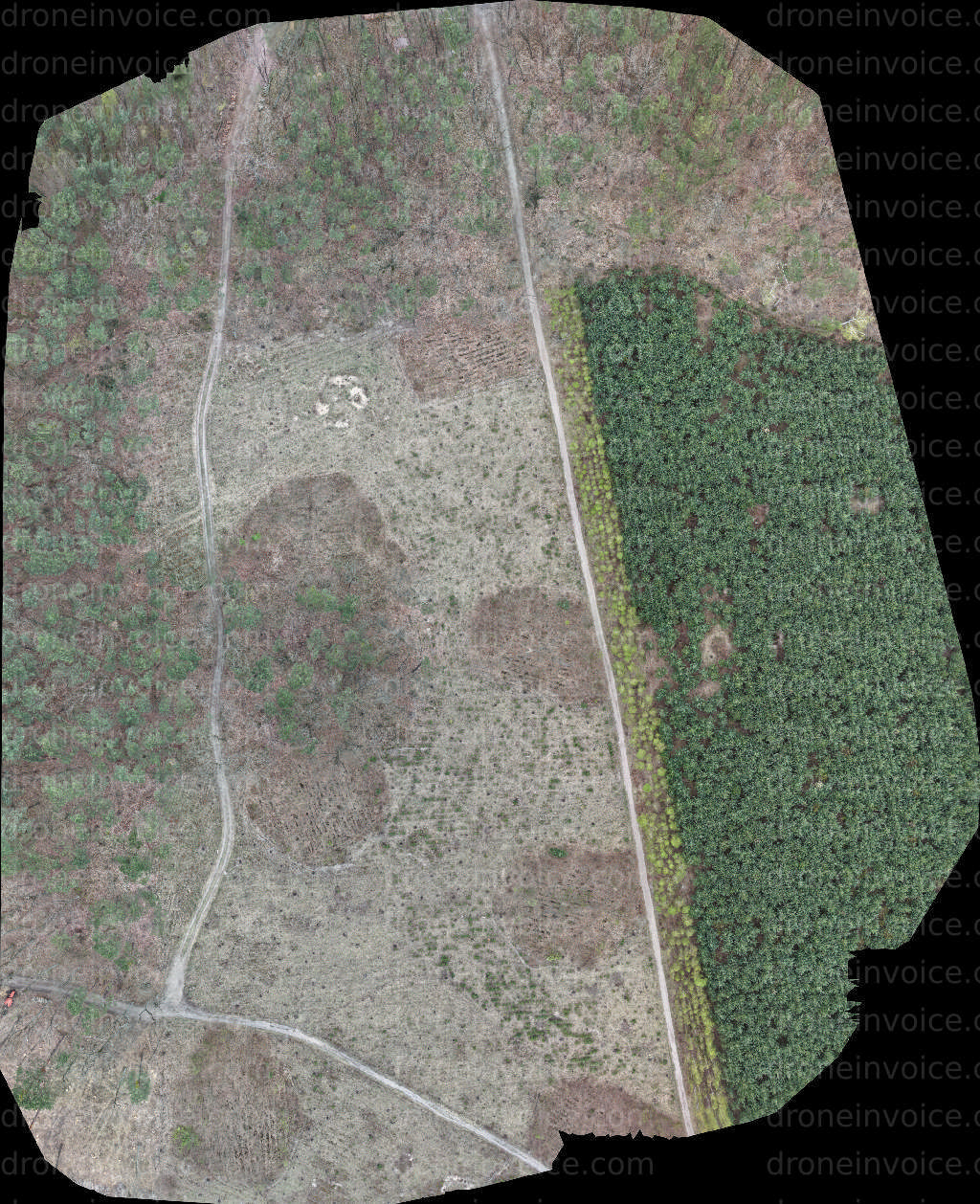
Drone Maps of Poland Available to Purchase
Poland, a country rich in history and diverse landscapes, offers a variety of stunning views—from the majestic Tatra Mountains to the serene Baltic Sea coastline. The country's unique architecture and vibrant cities, such as Warsaw and Kraków, provide fascinating subjects for aerial mapping. This page features high-quality drone maps of various locations across Poland, perfect for businesses, developers, and individuals seeking detailed geographical information.
Drone maps are essential tools for a range of applications, including real estate development, environmental monitoring, and urban planning. These maps capture detailed topographical information, allowing for enhanced analysis and visualization. Whether you are looking to purchase maps for personal use or commercial projects, our selection of drone maps covers a range of areas, providing comprehensive insights into Poland's landscape.
Types of Drone Maps Available
- Topographic Maps: These maps show elevation changes and contours, ideal for construction and land assessment.
- Orthomosaic Maps: High-resolution images stitched together, offering an accurate representation of a specific area.
- 3D Terrain Models: These provide a three-dimensional view of the landscape, useful for visual presentations and planning.
- Georeferenced Maps: Maps that are linked to geographic coordinates, perfect for GIS applications.
Why Choose Drone Maps?
Drone maps provide a level of detail and accuracy that traditional maps simply cannot match. They allow for better decision-making in various sectors, including agriculture, forestry, and construction. Here are some benefits of using drone maps:
- Precision: Drone maps are created using advanced technology, ensuring high accuracy in measurements.
- Cost-Effective: Aerial surveys reduce the need for extensive ground surveys, saving time and resources.
- Fast Turnaround: Drone mapping can be completed quickly, allowing for timely project updates and assessments.
- Versatility: These maps can be used for multiple applications, from environmental studies to urban planning.
How to Purchase Drone Maps
Purchasing drone maps from our marketplace is straightforward. Here’s a quick guide to help you navigate the process:
- Browse Our Collection: Explore the various maps available. You can filter by location, type, and resolution.
- Select Your Map: Once you find a map that suits your needs, click on it for more details and pricing information.
- Review Licensing Options: Choose the appropriate licensing package based on your intended use—commercial or personal.
- Add to Cart: After selecting your license, add the map to your cart and proceed to checkout.
- Download: Upon successful payment, you will receive a download link for your purchased maps.
Licensing Information
When purchasing drone maps, it's essential to understand the licensing terms. Depending on your project requirements, you may choose between different licenses:
- Personal Use License: Suitable for individual projects and personal research.
- Commercial Use License: Required for businesses using the maps for commercial purposes, such as marketing, consulting, or development projects.
- Extended License: For larger enterprises needing extensive use of the maps across multiple platforms and projects.
Contact Us for Custom Requests
If you need a specific area mapped that isn’t available on our site, please reach out to us. We can arrange custom drone mapping services tailored to your requirements. Our network of experienced drone pilots can provide high-quality maps for virtually any location across Poland.
FAQ
What resolution can I expect from the drone maps?
The resolution of the drone maps varies depending on the area and the type of mapping performed. Generally, you can expect high-resolution images that capture intricate details of the landscape.
Can I use drone maps for commercial purposes?
Yes, you can use drone maps for commercial purposes, but you must select the appropriate commercial use license when purchasing.
How are the maps delivered after purchase?
Once your payment is processed, you will receive a download link via email. You can then access and download the maps directly to your device.
Are there any restrictions on the use of the maps?
Yes, each license comes with specific terms and conditions. It’s important to review these details to ensure your intended use complies with the licensing agreement.
Can I request a custom drone map for a specific location?
Absolutely! If you need a drone map for a specific area not available on our site, please contact us. We can facilitate custom mapping services through our network of drone pilots.