Molega Road — South Brookfield, Nova Scotia (ns), Canada (ca)
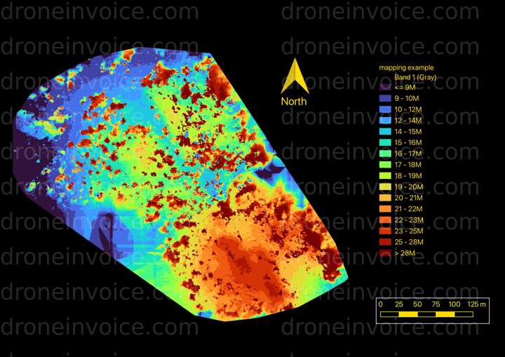
Digital surface models extract topography from drone flights, showing low points, contours, and tree canopy height.
Map
No location data.

Ultramax Drone Services
Last active 103 days ago
Drone services in Nova Scotia's south shore. Real estate, Site mapping, Inspections, Progress updates, Forestry Mapping.
https://ultramaxdroneservices.ca
License / Certification
Transport Canada Small RPAS Pilot
88 total views last week
Request a quote
View Pilot Portfolio