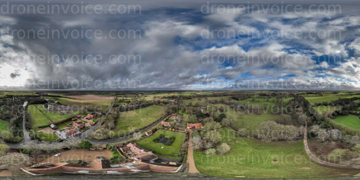
Drone media
Drone Photo captured on March 24, 2026. 5850x2925 (17MP)
Map
No location data.
WADiT Aerial Surveys
Last active 103 days ago
WADiT Aerial Surveys delivers advanced aerial photography, videography, mapping, and surveying solutions. Our experienced pilots are GVC-qualified (General VLOS Certificate) and operate under PDRA01 - Operational Authorisation.
License / Certification
GVC- PDRA01 - Operational Authorisation.
29 total views last week
Request a quote
View Pilot Portfolio